Subsurface Laser Scan and Multi-beam Sonar Survey of Former Historical Coal Mine Shaft
Undisclosed
Geoterra's subsurface laser scan and sonar survey of a former submerged coal mine shaft provided The Coal Authority with crucial data on structural integrity and water management.
The Brief
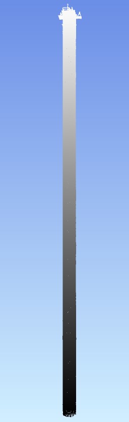
Geoterra was contracted by The Coal Authority to survey a partially submerged coal mine shaft in the UK. The survey aimed to assess the structural integrity of the shaft, which had partially collapsed and was filling with water after mine operations ceased. The subsurface laser scan and multi-bean sonar surveys were required to identify the collapse’s location and extent, approximately 300 meters below ground level, and to inform plans for installing a pump to manage the rising water.
The Solution
Geoterra, with partner Flodim, used advanced geospatial and sonar technologies for the survey. The following methods and equipment were used:
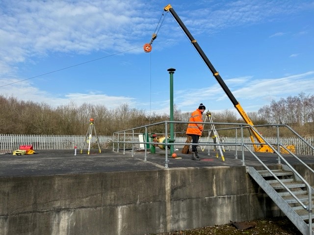
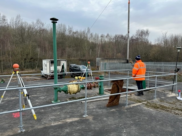
Access and Initial Setup:
- Severn Trent Water provided access by opening a 1m² hatch and cutting a wire mesh below.
- A crane lowered the equipment into the shaft via the surface shaft cap.
Survey Execution:
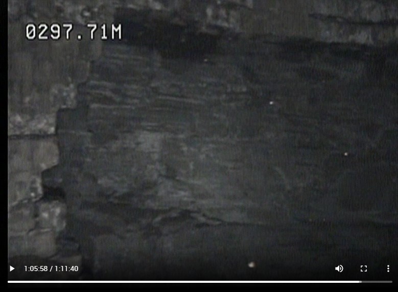
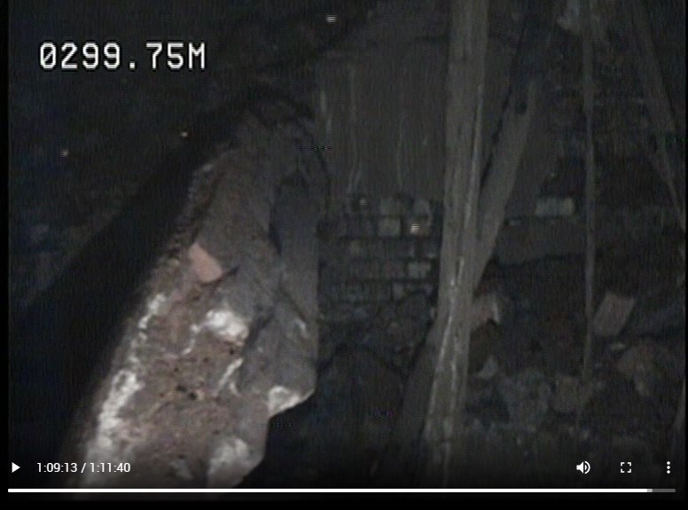
- Laser Scanning Above Water: The GEOSLAM Revo handheld laser scanner was lowered vertically to a depth of 100 meters to capture data of the shaft above the water line.
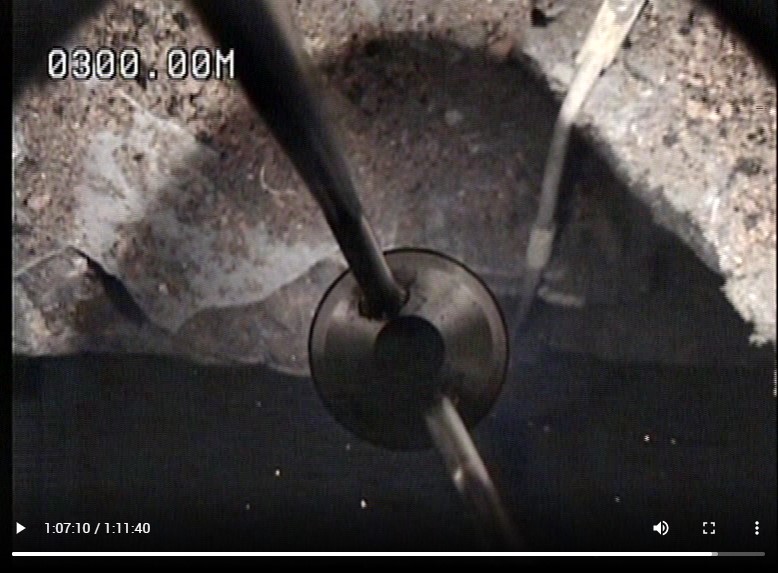
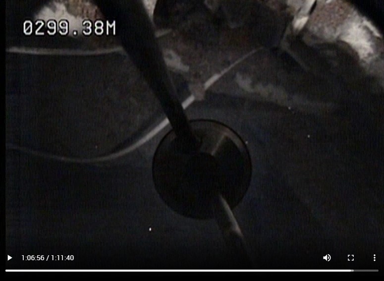
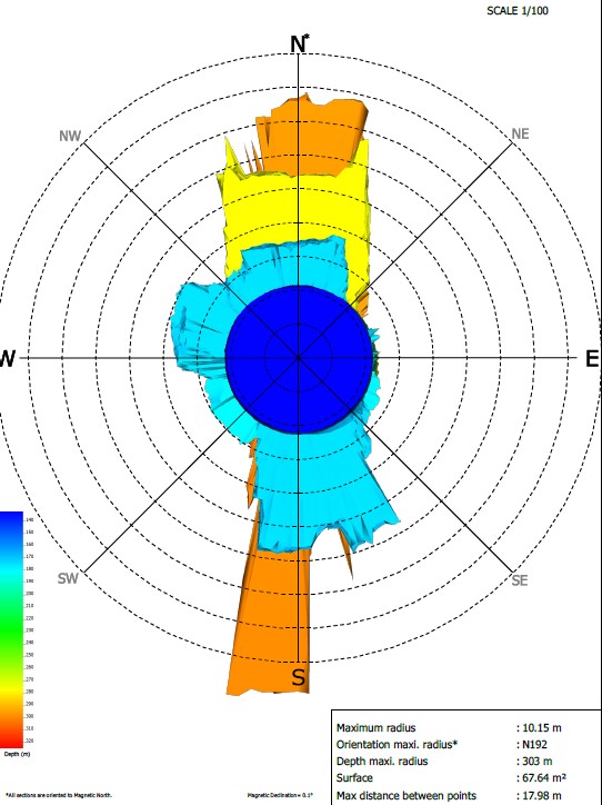
- Sonar Scanning Below Water: A specialist probe was used to safely lower the multi-beam sonar scanner to depths between 100 meters and 300 meters. The multi-beam sonar scanner performed a 3D scan of the submerged section of the shaft.
- CCTV Survey: CCTV surveys were conducted both above and below the water line to provide visual inspection of the shaft’s condition.
- Data Integration and Post-Processing: All data were referenced to the OSGB OSTN15 National Grid for accuracy.
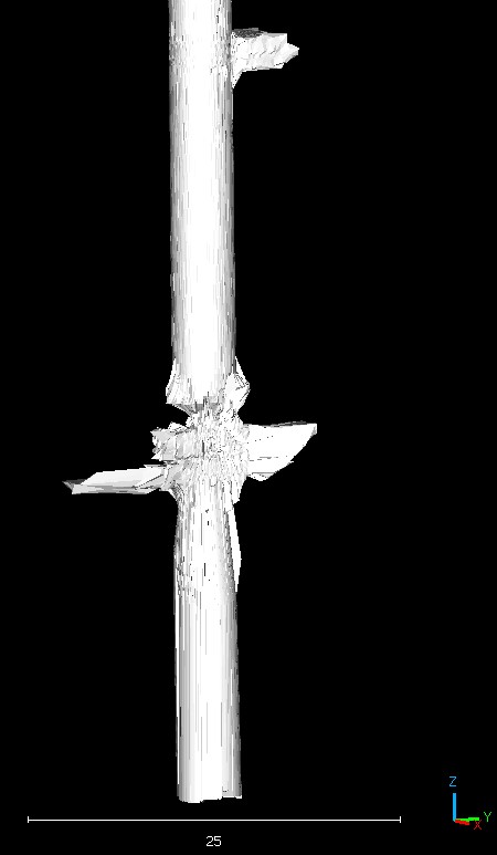
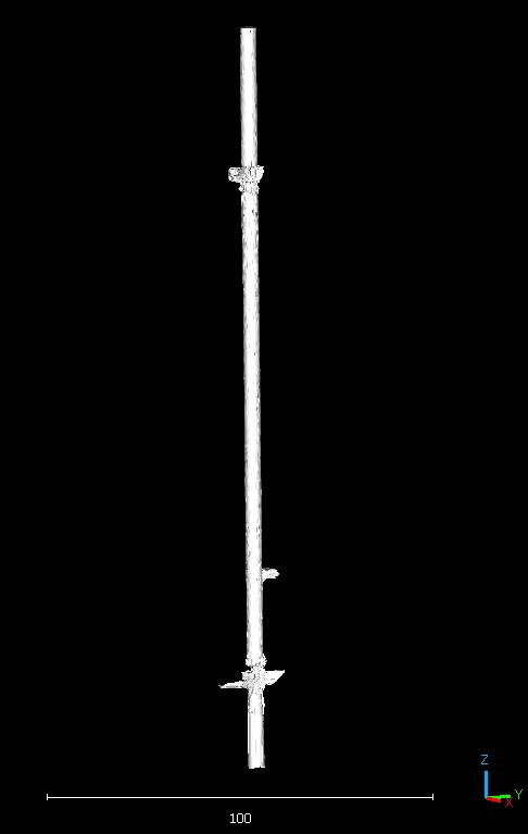
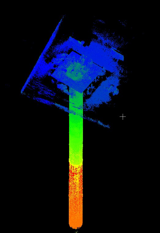
Surface laser scan data, subsurface laser scan data, and sonar scan data were combined to create a complete 3D model of the shaft.
The Deliverables
We provided the client with the following deliverables:
- A detailed 3D model of the shaft, showing both dry and submerged sections.
- Visual inspection reports from the CCTV surveys.
- Structural integrity assessment reports based on the scan data.
- Recommendations for installing a pump at the 300-meter level to manage the rising water.
This approach provided The Coal Authority with a clear understanding of the shaft’s condition, helping in future management and preservation efforts.